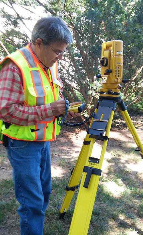
Covering Central Massachusetts and Metro West Boston, G.C. Wilson Company has gained an impressive record of repeat business and land surveyor referrals with public and private clients. We believe this is a testament to our land surveying service philosophy, which is to provide you with a competitively priced, high-quality land survey that exceeds your needs and deadlines so that you have a professional land survey you can trust each and every time. We are proud of our record in providing the most comprehensive surveying services for Central and Eastern Massachusetts.
Boundary Surveys
A boundary survey of the subject property will be made, and the property corners will be located and verified or reset. The improvements on the property will be located, and a check for violations or encroachments onto or from the subject property will be made. This survey can be used by the property owner to construct a fence, structure, or other improvements to the property.

ALTA/ACSM Land Title Surveys
This survey is performed on commercial property to supply the title company and lender with survey and location data necessary for issuing title or extended coverage title insurance. It covers all aspects of the boundary survey and improvement location and identification of any additional evidence of possession or use which could be adverse to the interests of the purchaser. This type of survey is normally only performed on commercial property because of the expense involved.
Topographic Plans
This is a survey of real property with the main purpose of determining the configuration of the surface of the ground and the location of all-natural and artificial objects, including utilities, drainage ways, structures, ingress and egress to the property, and any other visible limitations or enhancements to the property. This survey should be performed in conjunction with a Boundary Survey to show lines of possession and is normally conducted for architectural planning or engineering design projects.

Mortgage Inspection Plans
The sole purpose of this inspection is to obtain mortgagee title insurance. This is the minimum service that your lender requires for closing your loan. It is a location of improvements and a cursory check for violations or encroachments onto or from the subject property based on existing but not confirmed evidence. This does not constitute a boundary survey and is subject to any inaccuracies that a subsequent boundary survey may disclose. No property corners will be set, and they should not be used or relied upon to establish any fence, structure, or other improvement.
No warranty of any kind is extended therein to the present or future owner or occupant.
Lot Staking
Lot staking involves field surveying and office computations to locate or re-establish property corner markers and lot lines as recorded on deeds and plans at the local Registry of Deeds.

Flood Certificates
Flood Certificates report the relative vertical distance above or below a base flood elevation from a Flood Insurance Rate Map (FIRM). The FIRMs were produced by the Federal Emergency Management Agency of our federal government for use in the National Flood Insurance Program (NFIP). The FIRMs were designed to help determine whether property and buildings were in a special flood hazard area. The FIRM typically shows no facilities, and many minor or residential streets are not shown.
Land Court Surveys
The Massachusetts Land Court is one of the departments of the trial courts of the Commonwealth of Massachusetts. The court is unique because its subject-matter jurisdiction is limited to factual property disputes. The Land Court has a specific set of instructions regarding land surveys registered within the Land Court system. G.C. Wilson Company offers fieldwork that meets the criteria stated in the most recent Land Court Manual of Instructions for the survey of lands and preparation of plans.

Condominium Conversions
In order to create a condominium, the land and individual units are surveyed much like lots in a subdivision. A condominium plan is created and filed with the master deed and individual unit deeds. This plan will depict the dimensions of the units as well as the interior and common exterior area along with the parcel boundaries.
Certified Plot Plans
A Certified Plot Plan is a detailed land survey to accurately locate boundary lines and improvements on a property (house, sheds, etc.) in relation to those boundary lines. Certified Plot Plans are needed when planning any improvements to a property (such as addition, shed, or garage). The building inspector will quite often want to see the proposed improvements on paper in relation to the boundary lines to verify that the improvement will comply with zoning setback regulations.

Building Permit Plans
A survey was provided for a construction project to locate improvements to be made with information to control vertical and horizontal alignment and dimensions of the proposed improvements.
98 Sterling St, Clinton, MA 01510, USA
- Mon - Fri
- -
- Sat - Sun
- Closed